A 60-acre (25-hectare) plot in Washington University in St. Louis’ Tyson Research Center has been named a Forest Global Earth Observatory, or ForestGEO. The oak-hickory forest in the rolling foothills of the Ozarks joins a network of 51 long-term forest study sites in 23 countries, including eight others in the United States. Together, the forests, containing roughly 8,500 species and 4.5 million individual trees, comprise the largest, systematically studied network of forest-ecology plots in the world.
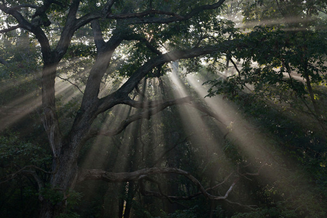
Why study trees? If the climate changes, people can pick up stakes and move, irrigate the land or spend more time in air-conditioned buildings, said Jonathan A. Myers, PhD, assistant professor of biology in Arts & Sciences. But trees, once they have rooted, do not have these options. These giant, long-lived organisms remain exposed to the elements, year in and year out, and are therefore sensitive barometers for the effects of climate change on the biosphere.
Forest plots in the American Midwest, which has been swept by drought, may also hold the answer to a critically important question about forests. Forests have long been one of the largest terrestrial carbon stores, sequestering megatons of the element in their tissues.
If drought-driven tree die-offs become more frequent will forests become carbon sources rather than sinks? The answer, which depends on complex processes operating over long time spans, is not obvious and yet it is critical for understanding future climate.
“The Tyson plot is a rich regional resource for forest research and environmental education,” said Kim Medley, associate director of the Tyson Research Center. “Its inclusion in an international network greatly expands its impact, providing an opportunity to contribute signifcantly towards understanding global-scale phenomena such as climate change.”
A forgotten forest
The Tyson ForestGEO isn’t just an ordinary stand of trees waiting to be tagged; it has a unique history that adds to its value. There are already 30 years of data on the plot, and the data span two of the worst droughts in the Midwest since the Dust Bowl in the 1930s.
When Myers came to Tyson in 2010 for his postdoctoral research, the staff at the 2,000-acre field station mentioned a forest plot there that nobody was currently studying. He learned more about the plot when Susan Flowers, outreach coordinator for Tyson, gave him a master’s thesis describing a census of the plot conducted between 1981 and 1982.
Myers was interested in trees. He had studied forestry at Paul Smith’s College, a small private college located on 14,200 acres of woodland in the Adirondack Mountains of New York. During his undergraduate studies, he worked as a botanist for the U.S. Forest Service in the Adirondacks and then began his graduate studies at Barro Colorado Island, a tropical forest preserve on an island in the Panama Canal administered by the Smithsonian Institution.
When he contacted Victoria L. Sork, PhD, the scientist who supervised the master’s thesis, now dean of life sciences at the University of California, Los Angeles, Myers was intrigued to learn there was a connection between Tyson and Barro Colorado.
Thirty years ago, he explains, ecologists Stephen Hubbell and Robin Foster spearheaded an ambitious project to tag, map, measure and identify every tree in a 50-hectare plot of the tropical forest on Barro Colorado Island. Hubbell and Foster wanted to test the idea that chance and history played more of a role in tropical than in temperate forests, building in variability that could help explain greater biodiversity in tropical forests.
Because they hypothesized that the fate of small trees (seedlings and saplings) was especially important in driving biodiversity patterns, they developed protocols to map and tag every tree in the forest bigger than one centimeter in diameter at breast height (1.3 meters).
This was the first time anyone had attempted such a large and comprehensive inventory of tropical trees, Myers said.
Barro Colorado became an iconic project in ecology and, eventually, the flagship of the Smithsonian Institution’s global network of forest dynamics plots.
As it turned out, Sork, then a professor of biology at the University of Missouri-St. Louis, knew about Hubbell and Foster’s work in the tropics. Together with her graduate student, Carol Hampe, she decided to establish a temperate-forest counterpart at Tyson. Hampe’s master’s thesis research culminated in the first census of the plot in 1982.
Crucially, the Tyson census made use of the same methods as the Barro Colorado census, so that once the Smithsonian network was extended to include temperate as well as tropical forests in 2008, the Tyson forest plot was a natural fit for the network.
A natural drought laboratory
Six years after the first census, something else happened that was to make the Tyson plot even more valuable. In 1988, there was a severe drought, complete with dust storms and wildfires. Following the great heat, Sork sent a research team back into the woods to re-census the plot.
But what will happen if climate change causes more frequent and extreme droughts that in turn lead to tree die-offs? Once fallen, a tree becomes a source rather
than a sink of carbon, releasing carbon through the ministrations of bacteria,
fungi and insects both to the atmosphere and to the soil. Is it possible that drought-stricken forests could become carbon sources rather than carbon sinks?
By looking for changes in the composition and structure of the forest over time, Myers and his colleagues hope to see the signs of such a change before the change is upon us.
The Pentagon of Doom
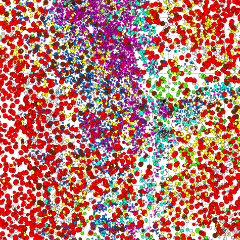
Like many forests in the Midwest, Tyson is dominated by only two genera of trees: Quercus, or oaks, and Carya, or hickories. But there are more than 39,000 stems bigger than 1 centimeter on the Tyson plot and each must be mapped, measured, identified and tagged. That’s a lot of work.
Fortunately, there are also students in the woods. “One of the really enjoyable parts of this project is the extent to which we’ve gotten high school and undergraduate students involved,” said Myers.
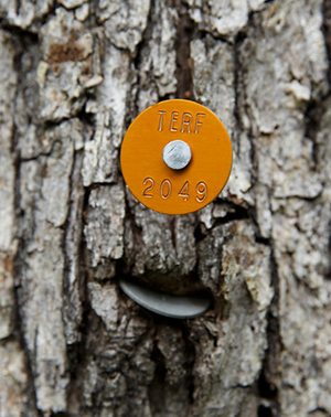
The students were sent his way by Flowers, assistant director of the Institute for School Partnership and director of an outreach collaboration between the Shaw Nature Reserve and the Tyson Research Center. Students trained in the Shaw program, called SIFT (Shaw Institute for Field Training), are embedded for a day with teams doing ecological and environmental research. SIFT graduates may then become TERFers (Tyson Environmental Research Fellows), working as interns with Tyson research teams for an entire summer.
“Jonathan has had both SIFTers helping him for a day, and TERFers embedded with his team for the past three summers,” Flowers said. To date, 28 high school students have contributed directly to field research in the Tyson plot.
“The high schoolers were actually the first ones in the plot,” Flowers said. “I sent them out to find it before Jonathan had decided what he was going to do. Not only did they locate all the old surveying stakes that first summer, they developed a dichotomous key (a tool for identifying species by looking for particular traits) to help prepare for the census. It was great.”
Still 39,000 is 39,000. Within some 20 x 20-meter sections of the plot, a student might be confronted with 300 or more trees. Some of the students named these thick sections the Pentagon of Doom or the Rhombus of Terror, Myers said.
But the names have been badges of honor. The students are clearly proud to be full members of a research team and to be generating data that will be shared globally with a network of scientists trying to answer some of the most important questions of our time. And Myers is happy to have a new generation of recruits to one of whom — who knows — he may one day pass on the plot.
This project is funded by the Smithsonian Institution Center for Tropical Forest Science and Forest Global Earth Observatories Grants Program; the International Center for Advanced Renewable Energy andSustainability, the Tyson Research Center, and Olin Library Data and GIS Services, all of Washington University in St. Louis. The National Science Foundation funded the SIFT and TERF programs.